
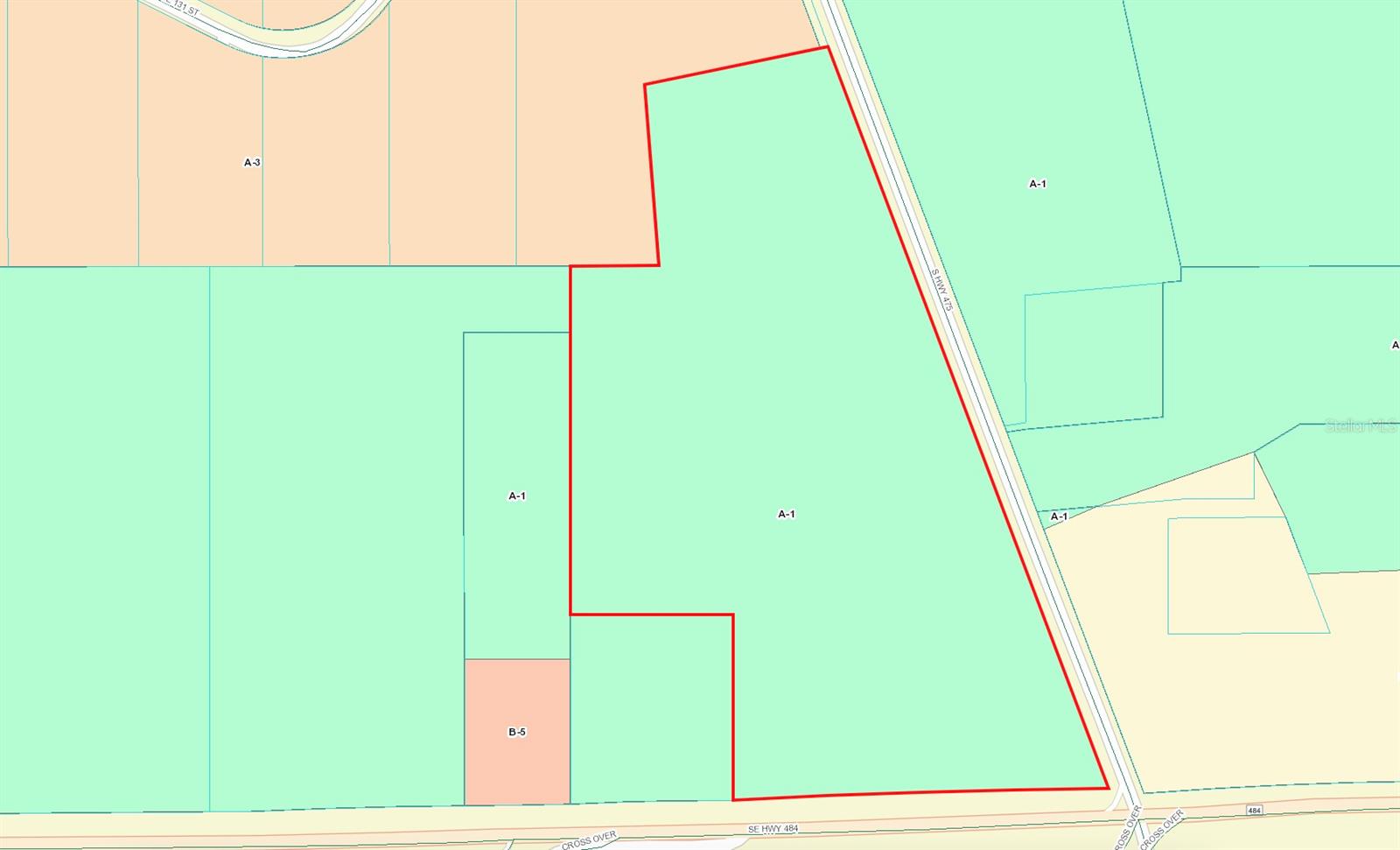
Corner Hwy 484 & Hwy 475, OCALA, FL 34480
Priced at Only: $2,500,000
Would you like to sell your home before you purchase this one?
- MLS#: G5090346 ( Land )
- Street Address: Corner Hwy 484 & Hwy 475
- Viewed: 384
- Price: $2,500,000
- Price sqft: $0
- Waterfront: No
- Year Built: Not Available
- Bldg sqft: 0
- Days On Market: 136

Description
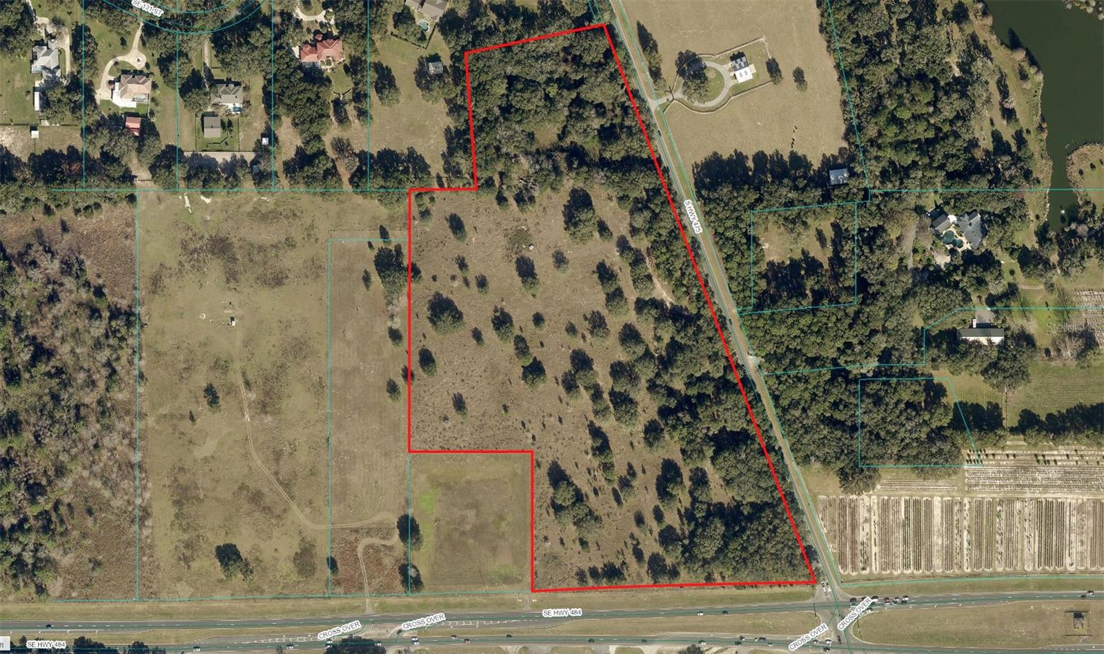
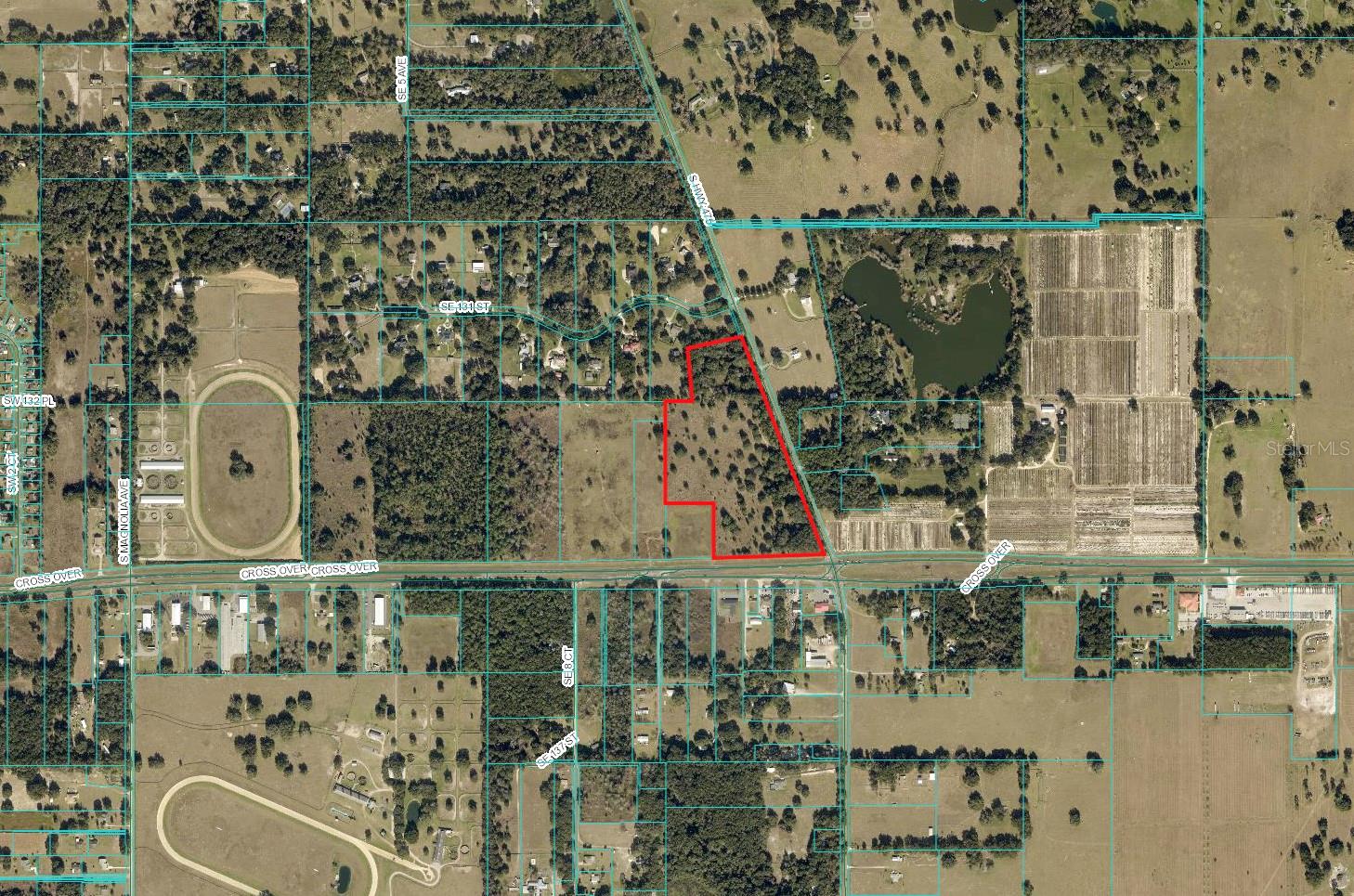
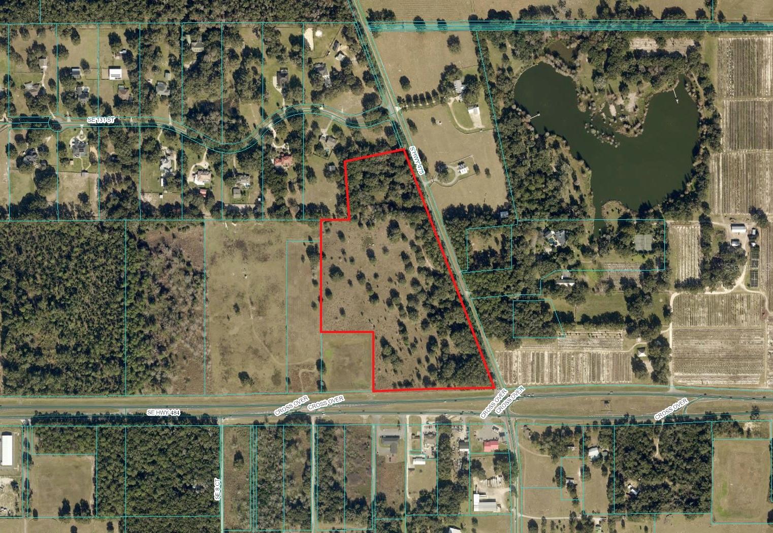
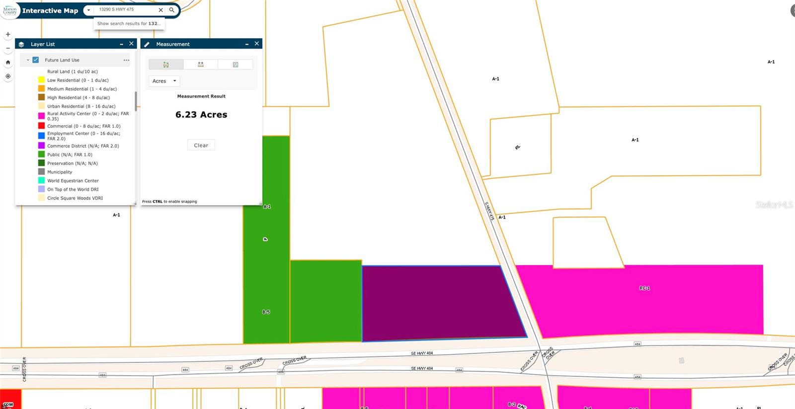
Development Potential: 26.68 acres at NW Corner Hwy 484 & Hwy 475 Signalized Intersection. Only 2 miles east of I 75. 6+ acres at hard corner designated land use for Rural Activity Center (RAC) Commercial / 26.68 acres currently A 1 zoning. 830 frontage on busy Hwy 484 in expansion with explosive growth heading west. Outstanding location for high volume retail development. Average daily traffic count: 21,800. Existing residential well on property. Florida Horse Park & Greenways located only 2 miles North on Hwy 475
Payment Calculator
- Principal & Interest -
- Property Tax $
- Home Insurance $
- HOA Fees $
- Monthly -
For a Fast & FREE Mortgage Pre-Approval Apply Now
Features
Building and Construction
- Covered Spaces: 0.00
- Living Area: 0.00
School Information
- High School: Belleview High School
- Middle School: Belleview Middle School
- School Elementary: Belleview-Santos Elem. School
Garage and Parking
- Garage Spaces: 0.00
- Open Parking Spaces: 0.00
Eco-Communities
- Water Source: Well Required
Utilities
- Carport Spaces: 0.00
- Sewer: Septic Needed
- Utilities: Electricity Available
Finance and Tax Information
- Home Owners Association Fee: 0.00
- Insurance Expense: 0.00
- Net Operating Income: 0.00
- Other Expense: 0.00
- Tax Year: 2024
Other Features
- Country: US
- Current Use: Commercial
- Legal Description: SEC 08 TWP 17 RGE 22 SE 1/4 OF NE 1/4 W OF SR 475 & COM AT NE COR OF SEC 8 TH W ALONG N BNDY TO THE W ROW LINE OF SR 475 TH S 20-29-00 E 910.14 FT TO THE POB TH S 78-18-10 W 405.81 FT TH S 04-25-50 E 392.49 FT TH N 89-58-10 E TO THE WLY ROW LINE TH N 20-29-00 W TO THE POB EXC THAT PT LYING WITHIN FOLLOWING DESC BOUNDARIES: COM AT NE COR OF SEC 8 TH S 00-04-17 W 2654.19 FT TH S 89-45-52 W 106.01 FT TH N 00-14-08 W 50 FT TO THE POB TH S 89-45-52 W 1213.16 FT TH N 00-03-56 E 520.36 FT TH N 90-00-00 E 353.87 FT TH S 00-00-00 W 401.86 FT TO A PT ON A CURVE CONCAVE SLY HAVING A RADIUS OF 17069.14 FT A CHORD BEARING OF N 88-16-08 E TH ELY ALONG ARC OF CURVE THRU A CENTRAL ANMGLE OF 02-44-02 814.24 FT TO END OF CURVE & POINT LYING ON EXISTING SWLY
- Area Major: 34480 - Ocala
- Parcel Number: 41482-000-00
- Views: 384
- Zoning Code: A1


