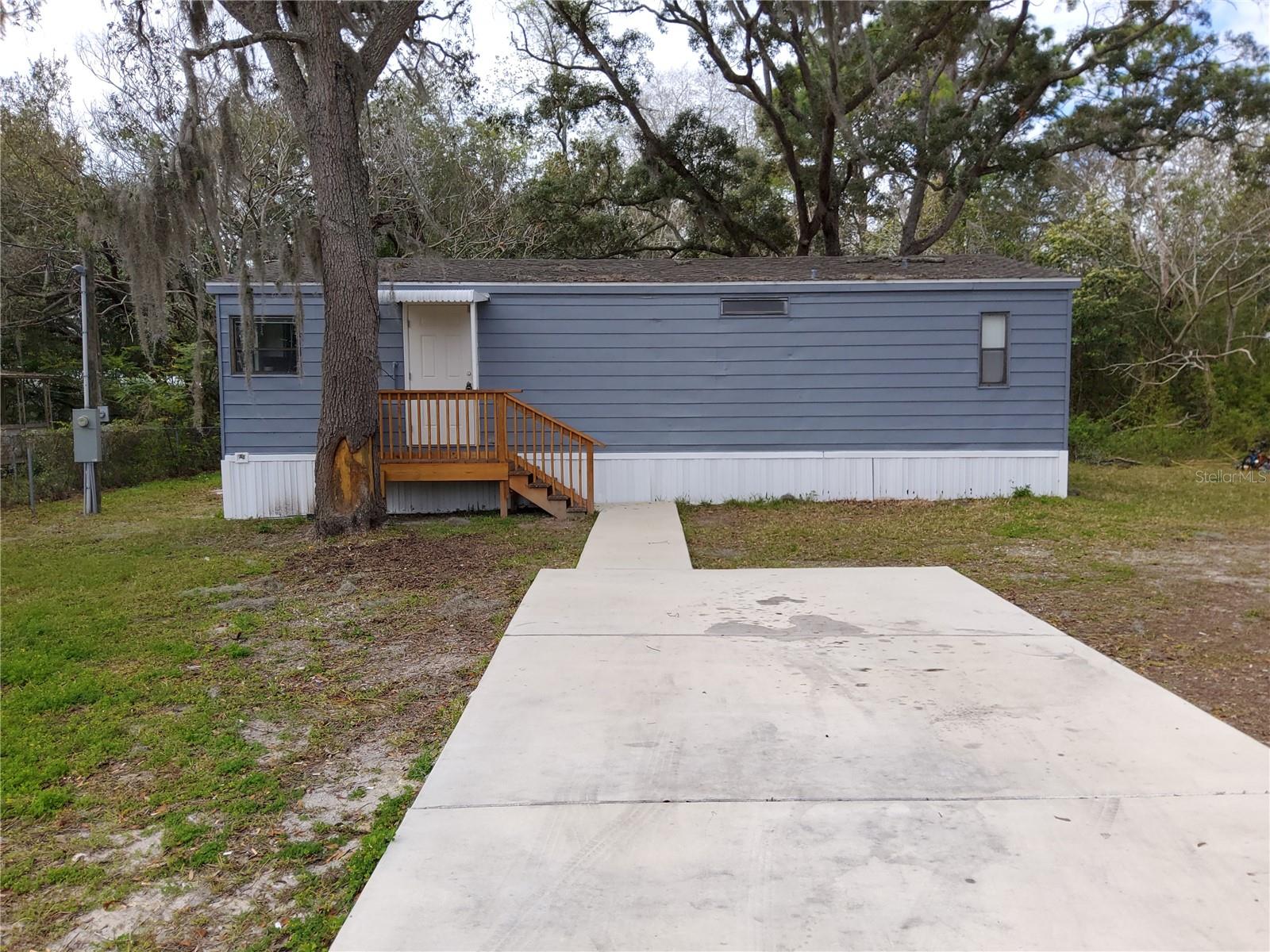
000 Sw Hwy 200, OCALA, FL 34481
Priced at Only: $550,000
Would you like to sell your home before you purchase this one?
- MLS#: G5031303 ( Land )
- Street Address: 000 Sw Hwy 200
- Viewed: 10
- Price: $550,000
- Price sqft: $0
- Waterfront: No
- Year Built: Not Available
- Bldg sqft: 0
- Additional Information
- Geolocation: 29.0568 / -82.281
- County: MARION
- City: OCALA
- Zipcode: 34481
- Provided by: GRIZZARD COMMERCIAL REALESTATE
- Contact: Daniel Tatro
- 352-787-6966

- DMCA Notice
Description
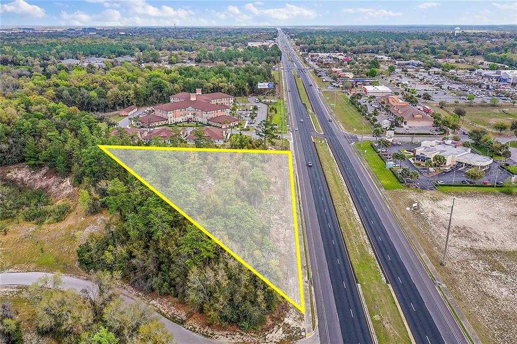
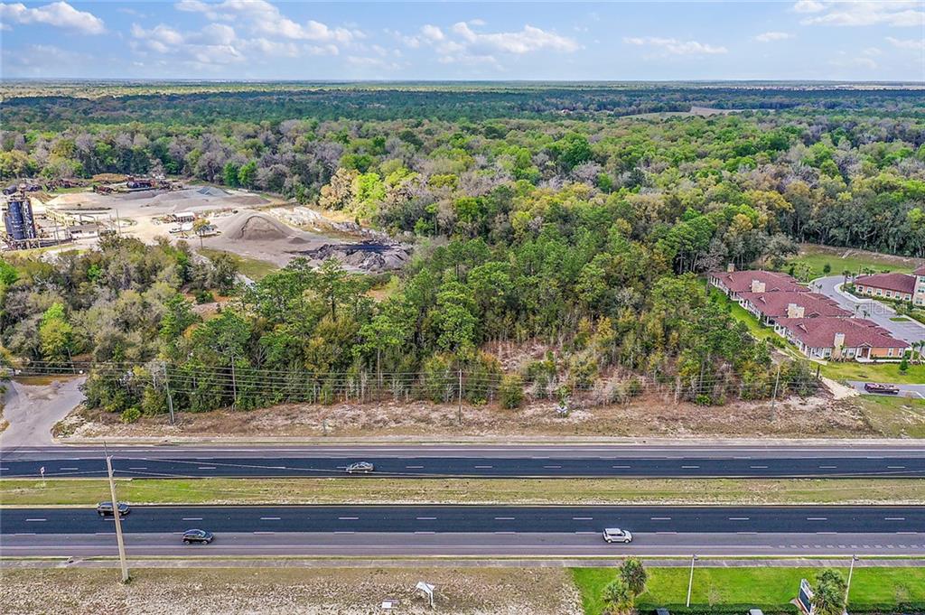
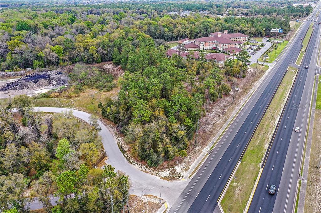
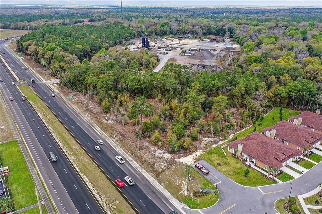
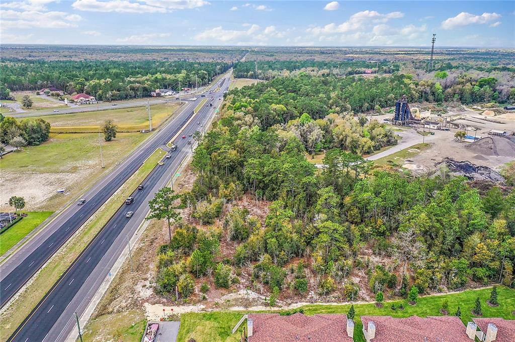
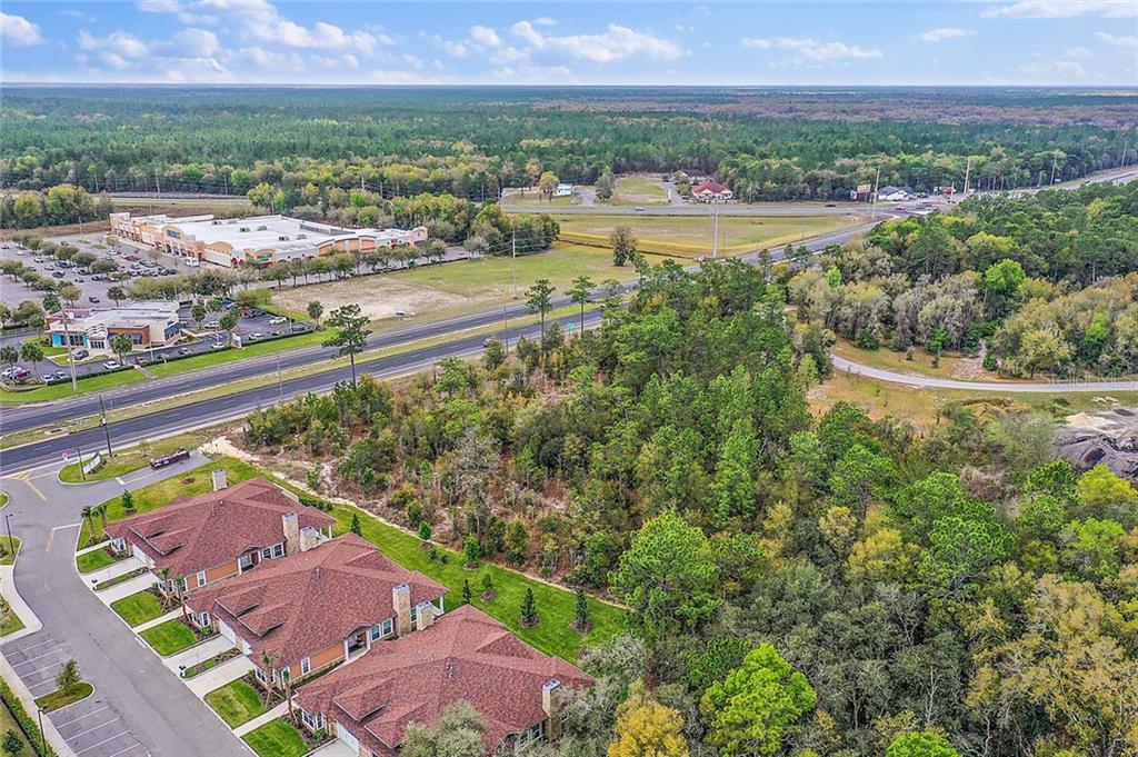
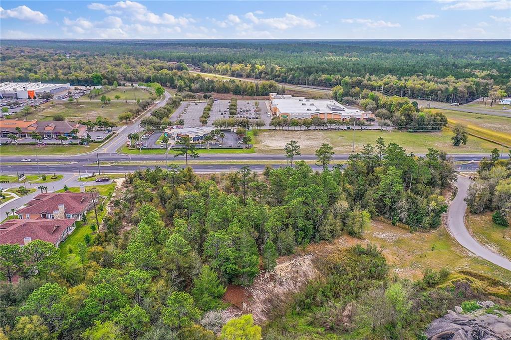
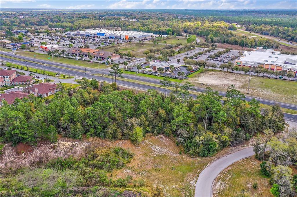
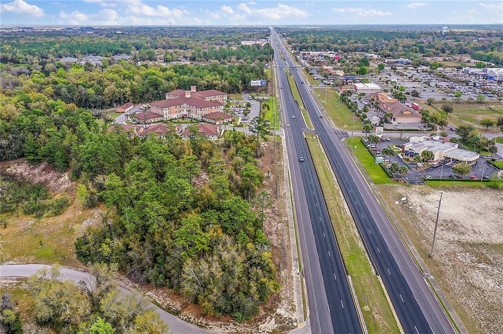
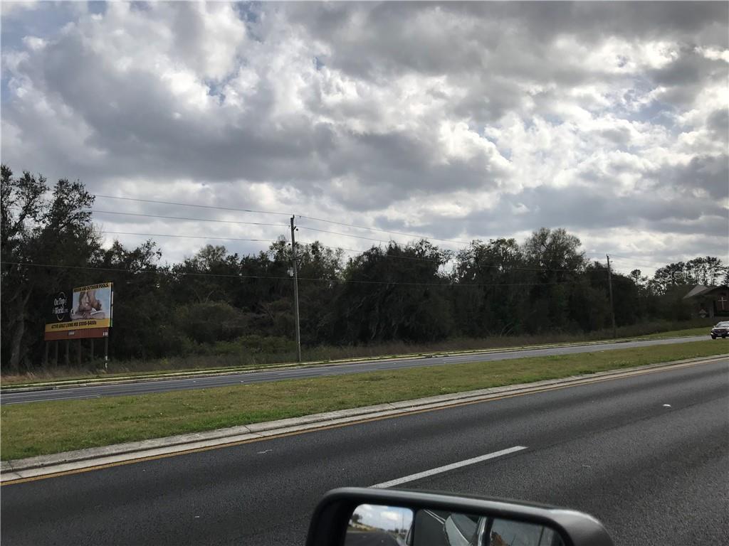
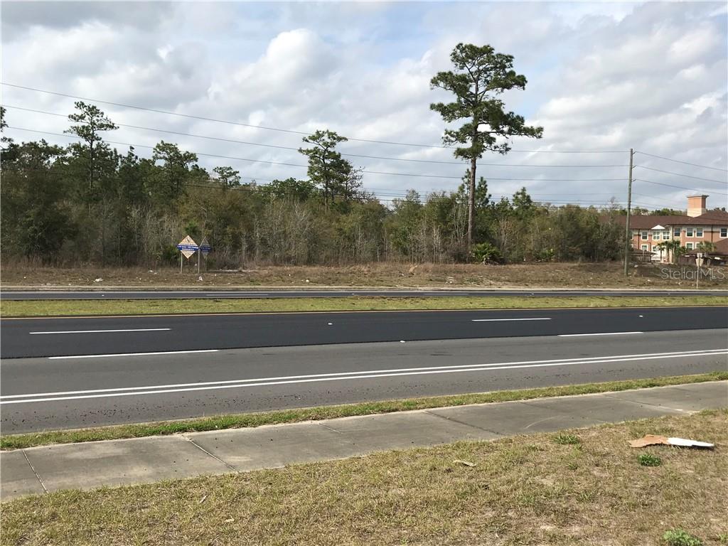
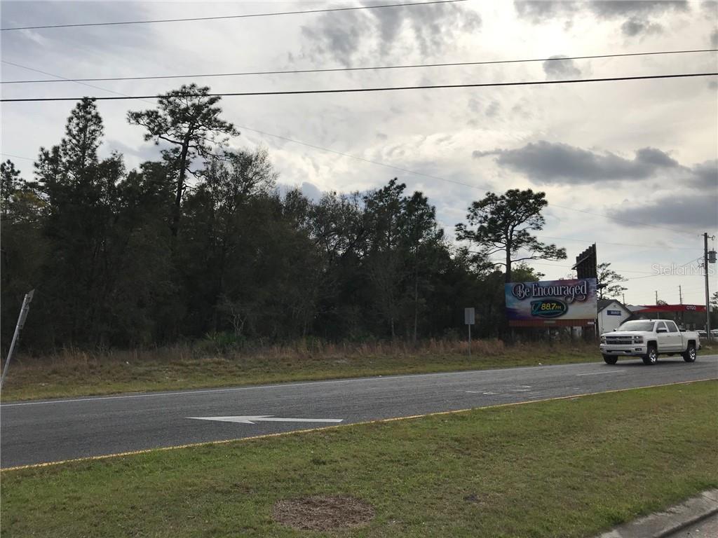
1.79+/ Acres, Zoned B4, 21,000 FDOT Avg Trips per Day, Site is close to Timber Ridge Commons & Advent Health & City Water near site. Located just over five miles west of I 75, the parcel is on the "S.R. 200 Corridor" of Ocala. Great demographics and location on State Road 200 (the major east west thoroughfare through Ocala) site is across from recently completed Wal Mart Super Center, Bealls, Canterfield of Ocala ALF, All information provided herein is believed to be accurate, but is not guaranteed.
Payment Calculator
- Principal & Interest -
- Property Tax $
- Home Insurance $
- HOA Fees $
- Monthly -
For a Fast & FREE Mortgage Pre-Approval Apply Now
Features
Building and Construction
- Covered Spaces: 0.00
- Living Area: 0.00
Garage and Parking
- Garage Spaces: 0.00
Eco-Communities
- Water Source: None
Utilities
- Carport Spaces: 0.00
- Road Frontage Type: State Road
- Sewer: None
- Utilities: Electricity Available, Water Available
Finance and Tax Information
- Home Owners Association Fee: 0.00
- Net Operating Income: 0.00
- Tax Year: 2019
Other Features
- Country: US
- Current Use: Commercial
- Legal Description: SEC 35 TWP 16 RGE 20 COM NW COR OF NW 1/4 TH S 01-07-24 E 1972.36 FT TO SW COR OF N 1/2 OF SW 1/4 OF NW 1/4 TH N 88-04-56 E 1322.68 FT TO POB TH S 61-23-33 E 395.56 FT TH S 40-11-40 W 520 FT TH N 01-08-24 W 586.72 FT TO POB & EXC SR 200 ROW LYING WIT HIN THE FOLLOWING DESC BDYS: COM AT THE PT OF INTERSECTION OF THE S LINE OF THE NW 1/4 OF SEC 35 WITH THE BASELINE OF SURVEY OF SR 200 AS SHOWN ON STATE OF FL DEPT OF TRANS ROW MAP PT BEING 1325.35 FT S 89-59-43 E OF TH SW COR OF NW 1/4 TH N 42-02-1 6 E 1997.29 FT TO THE PT OF INTERSECTION WITH THE E LINE OF NW 1/4 PT BEING 1163.30 FT S 00-40-10 W OF THE NE COR OF NW 1/4 TH CONT N 42-02-16 E 1574.55 FT TO THE PT OF INTERSECTION WITH THE N LINE OF THE NE 1/4 PT BEING 1040.78 FT N 89-39-32
- Area Major: 34481 - Ocala
- Parcel Number: 35341-002-07
- Views: 10
- Zoning Code: B4
Contact Info
Property Location and Similar Properties
Nearby Subdivisions
000
Classic Hills Un 01
Classic Hills Un 02
Estates At Cotton Plant
Estates Of Cotton Plant
Kingsland Country Lts
Lancala Farms
Marion Center
Marion Oaks Un 5
Not On List
Ocala Park Estate
Ocala Rdg Un 05
Pine Run Estate
Rainbow Park
Rainbow Park 02
Rainbow Park 08
Rainbow Park 4
Rainbow Park Estate
Rainbow Park Ranchettes
Rainbow Park U8
Rainbow Park Un 01
Rainbow Park Un 02
Rainbow Park Un 03
Rainbow Park Un 04
Rainbow Park Un 08
Rainbow Park Un 1
Rainbow Park Un 2
Rainbow Park Un 3
Rainbow Park Un 4
Rainbow Park Un 8
Rainbow Park Unit 3
Rainbow Pk Un 3
Rainbow Place Un 3
Rolling Hills
Rolling Hills 03
Rolling Hills 04
Rolling Hills Un 04
Rolling Hills Un Four
Rolling Hills Unit 3blk 90 Lot
Sec 24 Twp 15 Rge 24 Plat Book
Southern Tung Land Co
Unit 4 Rainbow Pk
West Wood Acres N
Westwood Acres
Westwood Acres North
Westwood Acres North Sub
Westwood Acres S
Westwood Acres South